The group has made research progress in the direction of urban flood risk assessment.

Flooding has become an increasingly prevalent natural hazard in cities, posing a serious threat to sustainable urban development. Flood risk is unevenly distributed spatially and tends to be more destructive to vulnerable neighbourhoods, further exacerbating the impact of the disaster on cities. Urban flood risk assessment requires the calculation of flood exposure and vulnerability. Current methods cover hydrological modelling, remote sensing observations and hydrometer sensors with some success. However, traditional hydrodynamic modelling relies on high-resolution data, remote sensing is limited by weather conditions, and widespread deployment of distributed sensors faces difficulties.
The emergence of socially-aware data provides new methods for flood monitoring. Rich data on social media can describe flood evolution through text and images, support hazard hotspot mapping, and assess flood impacts in combination with socioeconomic data. This study extracts urban high-risk flood footprints and investigates their impact on urban accessibility and equity through the use of multi-source social media data.
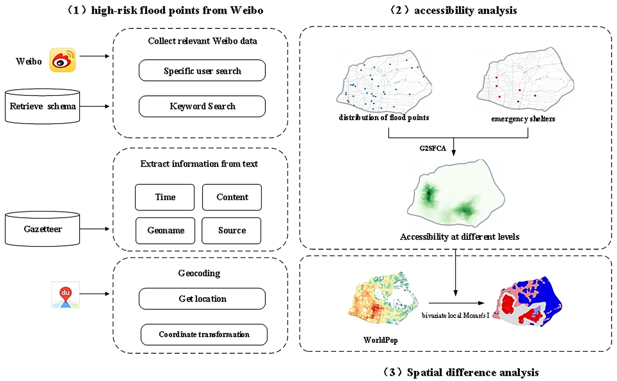
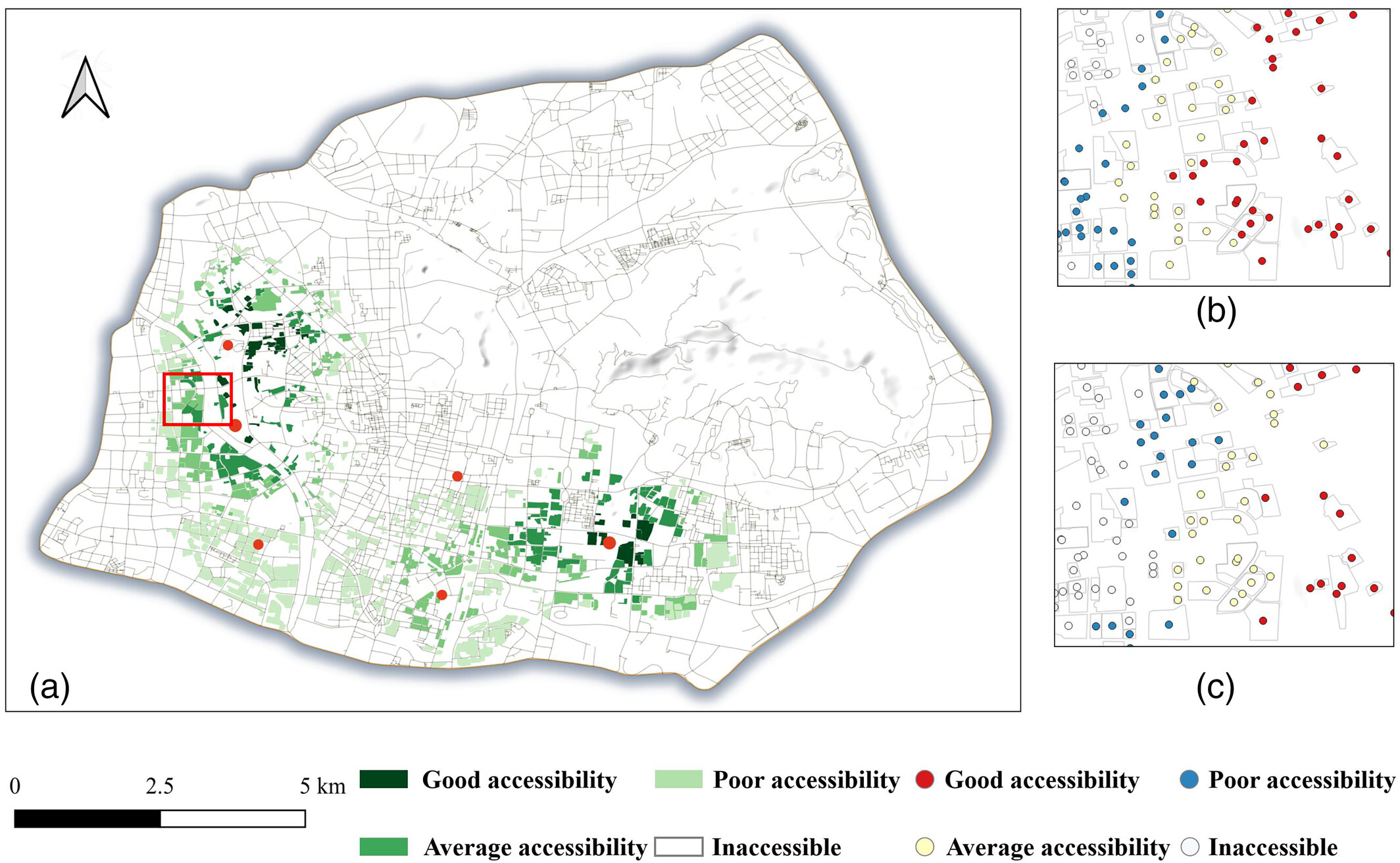
This study presents a comprehensive analytical framework for extracting flood-prone areas from social media data. Temporally, citizens' perceptions of heavy rainfall and flooding are in the same frequency as flooding events, and citizen observation data can well complement urban flooding research. Spatially, the main urban area of Nanjing has obvious deficiencies in the distribution of emergency resources. The synthesis suggests that urban flooding damages urban systems and requires strengthening of infrastructure and emergency policies. Such studies can provide knowledge for urban emergency management policies to meet the challenges of extreme rainstorms and flooding disasters.
First author:Lecturer Shaonan Zhu
Corresponding author: Assoc. Prof. Jun Zhang
Other authors: Yixin Jiang, Prof. Qiang Dai, Xin Yang
Link to the paper: https://onlinelibrary.wiley.com/doi/abs/10.1111/tgis.13127